![]()


This walk: 2012-10-25. Saddle Tor, Haytor Rocks, Low Man, High Man, dung fungi. Ilsington/Bagtor Manor boundary stone, Emsworthy Rocks, Emsworthy West Quarry, Rippon Tor, Haytor granite railway points, boundary stone, Blacksmith's Shop, chambered entrance tomb.
Walk details below - Information about the route etc.
Link to Google Satellite view of the area - the car park is on the bottom edge of the map.
Previous walk on this route: 22nd August 2012.

Walking up from the car park, Saddle Tor, SX 751 763, elevation 478 metres (1568 feet).

Distant view to Haytor Rocks, split into High Man and Low Man by rock climbers. Nearest is Low Man, little seen from the main road at Haytor.

Haytor Rocks, SX 7573 7705: the highest point is 457 metres (1499 feet) which is on Low Man, the western pile, left in this photograph.

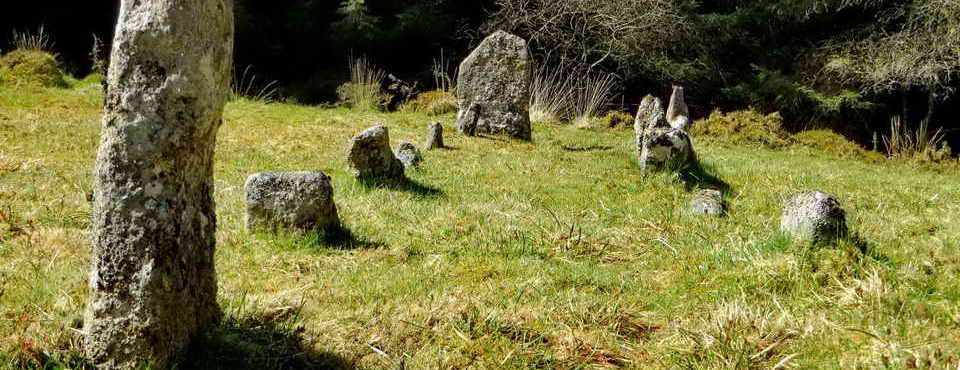
Rock piles on Saddle Tor.

Haytor from Saddle Tor.

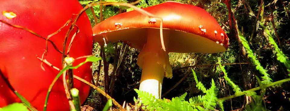
I thought these were Dung Roundheads (Stropharia semiglobulata) when I took the photograph but now I see that the far one appears to be "opening" so maybe they are Dung Bonnets (Bolbitius vitellinus), which are a little larger than Dung Roundheads. These are coprophilous fungi that break down dung. Perhaps both are present?

Pool seen en route.

Boundary stone at SX 75169 76684. Probably "Stone marked IB" on the 1884 map of Ilsington Manor Bounds, Source: Dave Brewer (2002) Dartmoor Boundary Markers, Halsgrove, p. 92.

B - Bagtor Manor .....

I - Ilsington Manor .....

Closer view.

Emsworthy Rocks.

Emsworthy West Quarry, SX 7522 7684.

Saddle Tor with a local pile in the foreground and Rippon Tor, SX 746 756, elevation 473 metres (1551 feet).

Switching points on the Haytor granite tramway, at SX 75329 76882. The Haytor complex of quarries was linked by the unique granite tramway, now a scheduled monument. It is 17 km long (10.6 miles), descending 400 metres (1300 feet) to the Stover canal at Ventiford. It opened in 1820 and closed by 1858, with a main line and six sidings to the different quarries. It was built by George Templer and sold later to the Duke of Somerset. The granite venture was eventually closed due to competition from cheaper sources that were nearer the sea, such as with Cornish and Scottish quarries.

The location of the points.

Emsworthy East Quarry also known as Harrowbarrow Quarry at SX 75325 76885.

Another view to Haytor, Low Man.

Haytor Rocks again, Low Man.

Believed Holwell Tor, SX 751 775, elevation 402 metres (1318 feet) ......

Holwell Tor with Hound Tor behind (at right), SX 742 789, elevation 414 metres (1358 feet).

Another view of Haytor Rocks, with High Man (left) and Low Man (right) .....

Low Man .....

Loa Man, zoomed, overhanging rock waiting to be climbed!

High Man, Haytor Rocks, SX 7587 7710. The link given before (here) states there are 30 routes in all grades of difficulty up to 80 feet high in this area of the rock .....

This is the easy way up!

Boundary stone, a stone alone (sorry!) at SX 75708 76729 (�3 metres)..... this may be bound stone no. 17, known as "Windsor" on an 1884 map of Ilsington Manor Bounds. Source: Dave Brewer (2002) Dartmoor Boundary Markers, Halsgrove, p. 92. It is also no. 25 on another map (Brewer, p. 98) where it is described as "Black Rock" in 1835 or "Windsor" at later dates, although the map reference (SX 7557 7655) does not agree with the one given here. However, Brewer describes it as being almost covered by vegetation: this stone may simply be an odd stone although it is set like a boundary marker.

Low Man (Haytor Rocks) with the unmarked boundary stone, probably one of 33 between the manors of Ilsington and Bagtor, dating from the C17th and C18th. The boundaries were made more obvious as a result of a survey in 1835.

Looking down on the bound stone - showing large crystals that resulted from slow cooling after the formation of the granite. The composition of granite was described here: 14 March 2012.

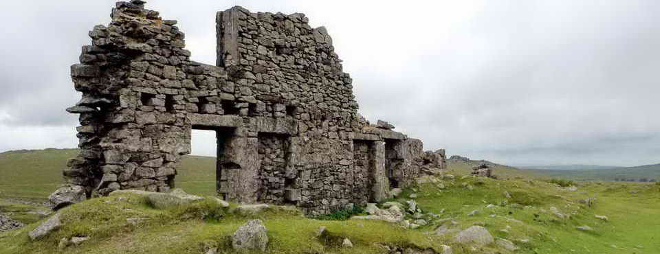
A large "B" mark (signifying Bagtor Manor) on a rock structure known as the Blacksmith's Shop at SX 75710 76453. Is there an I (for Ilsington) in the area? Bagtor was recorded in the Domesday Book as Bagethora. This mark is illustrated and described by Brewer, p. 100. His map reference for the mark is SX 7575 7638 .....

The "B" with Haytor Rocks behind .....

Quartz (SiO2, white) crystals? ..........

Closer view ......

Another closer view .....

Overview, see centre of the photograph .....

Another view of Saddle Tor from the Blacksmith's Shop .....

Another view of the Blacksmith's Shop: the "B" is on the top surface of the rock .....

Blacksmith's Shop from another direction.

The now-open (but overgrown) tunnel entrance into a chambered tomb at SX 75760 76398. An upright slab forming part of the other side of the tunnel can be seen at the bottom of the photograph, one-third the way in from the right. This ancient monument is very overgrown. J. Butler (1991), Dartmoor Atlas of Antiquities I, The East. 1.f Haytor chambered tomb, pages 21-22, describes it as being an entrance grave dating from the centuries around 2,000 BC i.e. 4,000 years old.
Link to chambered tombs on the Isles of Scilly.

View from the reputed chambered tomb ......

The tomb entrance (overgrown, foreground) with Haytor Rocks behind .....

Overview of the tomb with Haytor Rocks behind.
MAP:Red = GPS satellite track of the walk.

© Crown copyright and database rights 2012 Ordnance
Survey
Licence number 100047373
Also, Copyright © 2005, Memory-Map Europe, with permission.
This walk was reached by road from Bovey Tracey, off the A382, following signs to Haytor, with parking at the yellow cross by the P symbol on the map.
Statistics
Distance - 4.32 km / 2.68 miles
All photographs on this web site are copyright ©2007-2016 Keith Ryan.