![]()


This walk: 2014-9-25. Combestone Tor, clapper bridges, Dartmeet, Sharp Tor, Luckey Tor, rock exposure, River Dart, Yar Tor, Mel Tor, Bench Tor, Venford Dam, dead tree, Dartmoor pony.
Walk details below - Information about the route etc.
Google Satellite view of the area - including the GPS track of the walk (compare with the Ordnance Survey map plus track below)
Previous walk in this area: 3 December 2008 & 10 October 2012

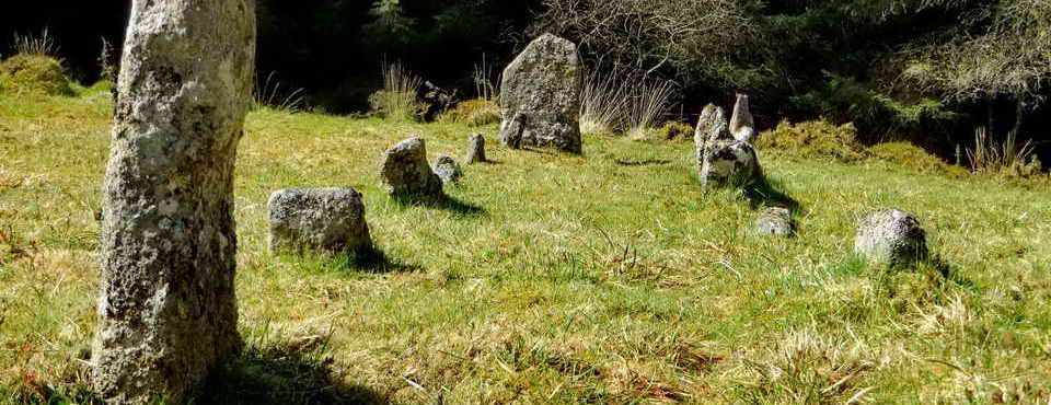
Combestone Tor,
SX 670
718, elevation 356
metres (1168 feet), from the car park .....
Another view.

Looking down into the Dart valley behind the tor.

Clapper bridge, SX 67122 71871, over the dry Wheal Emma Leat.

Second clapper bridge at SX 67183 71902 over the flowing Holne Moor Leat.

Third clapper bridge at SX 67498 71841, over a stream flowing down to the River Dart.

General view towards Dartmeet .....

Photo taken from close to SX 67670 71965 showing THIS SCENE at just above the bridge at Dartmeet (going up the hill towards Two Bridges), 1.33 km (0.83 miles) distant: mystery solved!

Looking back at Combestone Tor, looking for paths through the bracken field .....

As previous photograph.

Sharp Tor, SX 686 729, elevation 380 metres (1246 feet).

Looking along the path above the wood.

As previous photograph, a dead tree .....

Dead tree trunk, close-up.

Luckey Tor, aka Looka Tor, Lug Tor, Raven Rock, SX 6848 7208 elevation 220 metres (721 feet) .....

Zoomed view.

Rock exposure beside the path close to SX 6836 7166; believed Dartmoor Intrusion - Microgranite. Igneous Bedrock formed approximately 271 to 307 million years ago in the Permian and Carboniferous Periods. Local environment previously dominated by intrusions of silica-rich magma: intrusions of silica-rich magma. These rocks were formed from silica-rich magma intruded into the Earth's crust. It cooled to form intrusions ranging from large, coarse-crystalline, often granitic, batholiths to smaller, fine to medium crystalline, often rhyolitic, dykes and sills. (Source: British Geological Survey's Geology of Britain viewer).

A view of the Dart valley .....

The River Dart - here it is also known as the Double dart because it is the combined East and West Dart rivers flowing below dartmeet .....

As previous photograph.

View to Sharp Tor, including the Rowbrook properties ..... see celow .....

A more pointed view of Sharp Tor .....

Car park at Yartor Down (SX 68015 73258) with Yar Tor behind .....

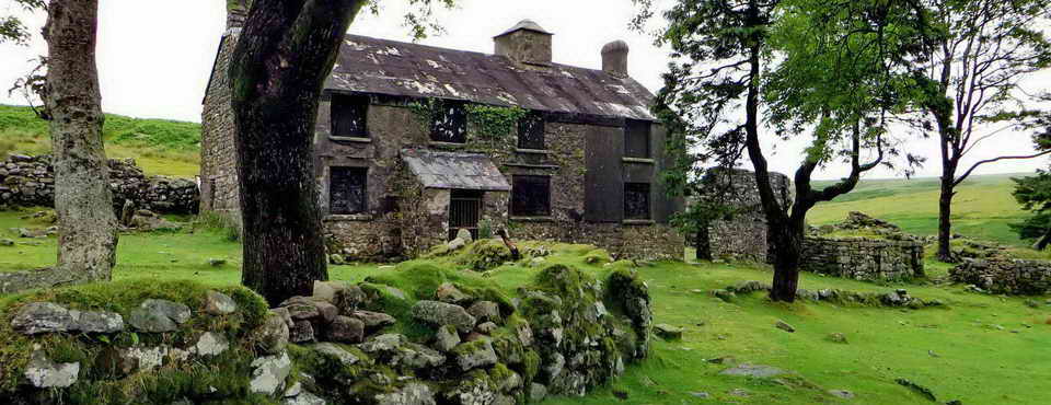
Rowbrook, SX 6841 7250 ......

Rowbrook House, SX 68710 72483.

Yar Tor (left) with Mel Tor towards the right - SX 693 725, elevation 346 m (1135 ft) .....

Zoomed view to Mel Tor, and looking to the right .....

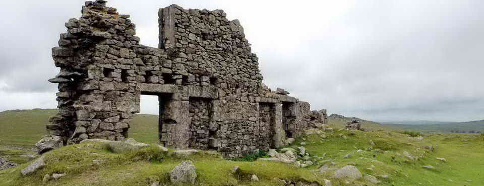
Bench Tor, SX 6920 7160 - a long tor, elevation 312 m (1023 ft) .....

Looking further right - more Bench Tor .....

Zoomed view.

View to Venford Reservoir .....

Venford Dam .....

As previous photograph.

Buildings below Venford Dam .....

Zoomed view.

Plank bridge at SX 68318 71508 over the Holne Moor Leat .....

From the previous photograph - a view to distant Rippon Tor, SX 746 755, elevation 473 m (1551 ft), 7.48 km (4.65 miles) distant.

The River Dart again .....

River Dart .....

River Dart .....

River Dart.

Luckey Tor again .....

Zoomed view .....

Zoomed view, it looks like a challenging climb.

A sharp bend in the leat, close to SX 6750 7146.

Looking down a tinners' gert, close to SX 6727 7155.

Dead tree.

Combestone Tor and a Dartmoor pony.
MAP: Red = GPS satellite track of the walk.

Statistics
Distance - 5.07 km / 3.15 miles.