![]()


Old maps .....
Ordnance Survey, Six-inch to the mile - 1888-1913

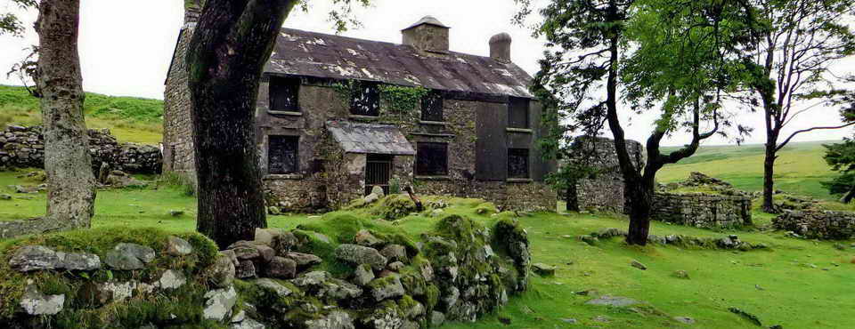
Approaching the Ice Works through the front entrance - in fact, the only entrance?

Looking up the approach into where the ice store used to be.

Examples of holes drilled by the rockworm .....

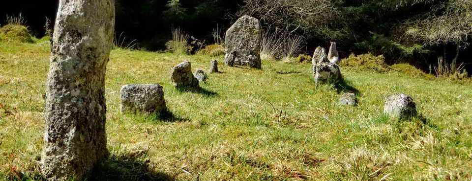
Outline of a large pit or possibly a roofed building, said to be insulated with hay and bracken ..... the ice came from nearby long reservoirs, filled by streams (see the movie below). The ice was transported by horse and cart to fishmongers in Plymouth . The enterprise started around 1875 and operated intermittently for about ten years .....

Looking the other way, seemingly part of a small building .....

The group leaving the pit area .....

A short reservoir adjacent to the pit area .....


Google Earth image: there appear to be five long reservoirs and a short one (marked by the mapping pin). The pit area with remains of building structures is approximately in the centre of the image with a long pile of spoil earth leading just east of north and the old approach track going out towards the top-left.
Dartmoor CAM
movie. TIP .....
A torn around panorama of the ice works site. |

|

Zoomed view to Meldon Reservoir.

Sourton Tors, SX 543 898, elevation 440 metres (1443 feet), known as East Tor locally because that is where it is, from Sourton!

A rockworm nest? Any guesses?

Closer view.

The triangulation pillar on the tor - this was taken during the 'recce' on 11th June when we estimated the wind up here to be the equivalent of putting your head out of a car window when travelling at 60 mph - very strong! .....

He is not kidding!

Anyway, after Ron blowed away .....

There was a fair view of the surrounding countryside.

A backward look.

A pony backed up to a rock for shelter - it was quite breezy up here today on the walk ......

Concentrating on the pony - tending towards a Palomino-type with a white blaze (Palomino images).

Unknown relict, possibly a tinners trial pit?

AHA! We know what these are now, don't we?! Thufurs, indicating that Dartmoor was certainly periglacial during one era in the past, suffering seasonal frost soil cryoturbation at the end of the last ice age. Encyclopaedia.com definition..

Standing near the head of Deep Valley, also known as Withecombe Bottom.

Zoomed view to Lake Viaduct (Youtube movie).

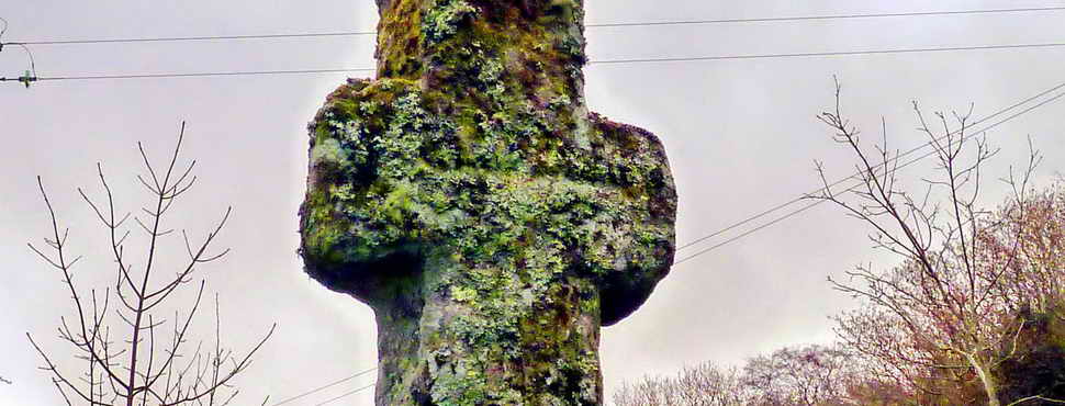
Boundary stone at SX 54464 89516 between Sourton (So) .....

..... and Bridestowe (B) .....

Showing the context of the stone -
At the southern end of the deep boundary ditch and reave at the head of Deep
Valley stands a boundstone inscribed �B/So�,
the stone and ditch marking the boundary between Bridestowe and Sourton Commons,
the land to the east shared by both parishes, that to the west being the
preserve of Sourton only. North of this point, the area of land encompassed by
the ditch (P460)
and the modern parish boundary line is known as The Triangle, an area rescinded
to Okehampton parish following a boundary dispute at a now unknown period prior
to the mid nineteenth century. It has been suggested that the boundstone here
marks the former site of Iron Gates, or Iron Catch Gate, itself a former
bondmark of the parishes, but the true location of the gate is disputed (q.v.
grid square 5490)."
Source: Mike Brown's CDROM "Guide to Dartmoor", 2001.

Dew pond and Sourton Tors.

Section of the deep boundary ditch.

The usual suspects!

Apple crushers at SX 54642 89599, half, damaged. It is said that they were always made in two halves, is that correct?

Them again .....

Another section of the deep boundary ditch: whoever dug this did a lot of work.

Another view.

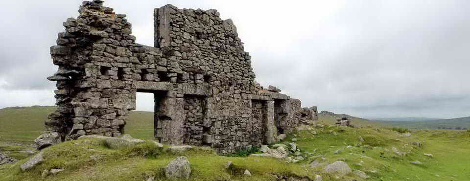
The top end of Greep Quarry .....

Stone from the quarry was used to build Sourton vicarage, the Wesleyan Chapel and other Victorian buildings.

Another view into the quarry.

Zoomed view to Meldaon Dam, built 1972.

Another claimed site for Iron gate - at least it appears to be a gatepost. Iron Gate is claimed to be at several locations in this area, the King Way. This was a 15� mile track between Tavistock and Okehampton. In 1720, a regular post boy route was established to carry "the King's Posts" from London to Plymouth. Source: "Track 11: The King Way" in Eric Hemery (1986), Walking Dartmoor's Ancient Tracks: A guide to 28 routes, Robert Hale, London, pp. 123-140.

South West Water's Prewley Water Treatment Works, built in 1950 (Source: A Dartmoor Century, 1883-1983: One hundred years of the Dartmoor Preservation Association, p.14) .....

Closer view.

A form of creeping "buttercup" with leaves superficially like pine-needles!

One of the bog cottons or cotton grasses: either Common cotton grass,Eriophorum angustifolium, with several seed heads, or Hare's tail cotton grass, Eriophorum vaginatum, with a single seed head.

This flower looks a lot like wood sorrel, Oxalis acetosella, but in a bog situation?

As previous - must remember to include leaves although that was difficult here .....

As previous photograph.
MAP: Red = GPS satellite track of the walk.

This walk was reached from the A386 after passing through Sourton, towards Okehampton, and turning right at the next opportunity before end of the straight stretch of road at a brown tourist sign (on the left, opposite the turning) for the "Granite Way" and parking beside this road, marked by the yellow cross on the map.
Statistics
Distance - 4.33 km / 2.69 miles.
All photographs on this web site are copyright © 2007-2016 Keith Ryan.
All rights reserved - please email for permissions