![]()


This walk: 2010-11-3. William Rees Jeffreys, Grimstone & Sortridge leat, Vixen Tor, cist, SB/WB parish bound stone, Sampford Spiney parish and Whitchurch parish bounds, Heckwood Tor, feather & tares, broken trough, clapper bridge, Feather Tor, lichen, apple crusher / cider press, fungi, Windy Post or Beckamoor Cross, Bullseye Stone, wooden wedge marks, Barn Hill, Blacksmith's Shop, Whitchurch Common, wheelwright's form, aqueduct, longhouse.
Walk details below - Information about the route etc.
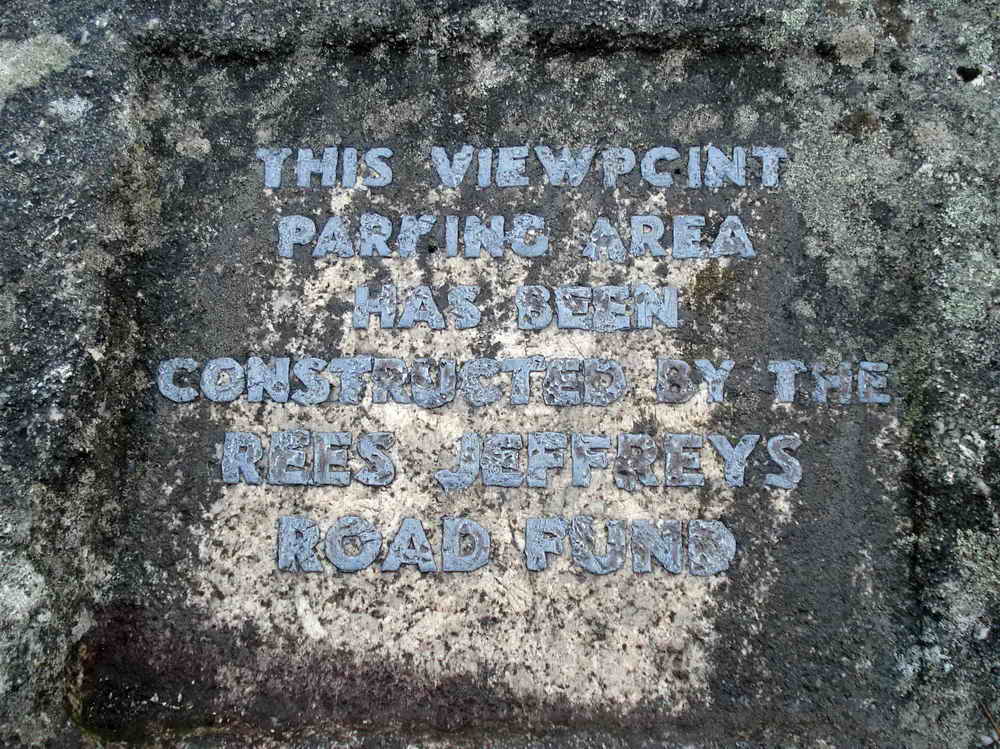
Plaque in the car park mentioning the Rees Jeffreys Road Fund - this links to their web site! See also William Rees Jeffreys, the man, who was responsible for roads being classified as "A" & "B" roads.

The Grimstone & Sortridge Leat, looking west, seven miles long, supplying "pot" water to Grimstone Manor (1300's), Sortridge Manor (1558) and also to Sortridge Consuls mine in the 1850's.

Looking east - the way we went, towards Vixen Tor.

Vixen Tor, aka The Egyptian Sphinx, SX 542 742, elevation 317 meters (1040 feet). The stack is about 30 metres (100 feet) in height .....

A closer view, with the cist in the left foreground ..... viewed from the north .....

Vixen Tor cist - to which access is sadly forbidden for the present .....

Whilst we were looking over the wall someone appeared to be inspecting the tor.

A set bound stone in the wall around Vixen Tor: "SB" denoting Sampford Bounds i.e. Sampford Spiney Civil Parish boundary and .....

"WB" denoting Whitchurch Bounds i.e. Whitchurch Civil Parish boundary (Source: Dartmoor Boundary Markers, Dave Brewer, Halsgrove, 2002, page 166)

Misty view towards King's Tor.

"SS P" denoting Sampford Spiney Parish .....

"WB" again (Whitchurch Bounds): all the stones in the area are described on page 168 in the Dave Brewer book (details above).

Vixen Tor as seen from the south-west.

Heckwood Tor, SX 537 738, elevation 321 metres (1053 feet).

A shaped piece of granite left in situ for some reason, a cancelled contract, perhaps?

A set of feather and tares for splitting granite along a line of pre-drilled holes by inserting the two tares and hammering in the central feather (or plug). Pressure was gradually built up along a line of these devices until the rock "gave" and split.

Another view on the tor .....

Looking for a discarded broken trough by a solitary tree, here the rock has clearly been split in several pieces .....

The trough, found by Hugh, at SX 53742 73903 � 4 metres. The near-right corner is split off from the main piece of stone - once featured in Broken Troughs Weekly (now renamed Monument Masonry News).

Clapper Bridge over the leat, near SX 5353 7401.

Looking up at Feather Tor, SX 535 741, elevation 313 metres (1026 feet).

Unidentified lichen seen along the way - it was here that I realised my macro setting on the camera had been turned off until now, so the earlier fungi were not worth putting on this web page, sorry.

A discarded apple crusher, believed damaged, at SX 53475 74070. A wheel would have run around inside the outer lip of this stone to crush apples for cider-making.

Showing the location of the cider press in relation to Feather Tor.

Horizontally bedded granite at Feather Tor.

Unidentified fungi .....

As previous photo.

Windy Post or Beckamoor Cross , marking the Abbot's Way from Merrivale Bridge to Moortown. The object of interest regarding water is seen in the following photograph ..... the cross has chamfered edges and probably replaced an earlier cross on the trans-Dartmoor packhorse track .....

The main leat flows from the top of the photo, going mostly to the left, down to Moortown, Oakley Farm, Sortridge and beyond. Some water passes through a "Bullseye Stone" (marked as such on the map) to Pewtor Cottage and beyond.

Looking back at the splitting of the leat, with Windy Post beyond.

Feather and tare marks being pointed out along the edge of this stone and .....

..... here, the marks are seen clearly against the water in the leat but so, too, is a line of wooden wedge marks where there was another attempt to split the stone. Perhaps this happened at a time when feather and tare was just becoming popular as the preferred splitting method? The wooden wedge method worked by inserting dry wedges into grooves and wetting them, then waiting for them to swell (overnight) and split the stone.

Rocky outcrop on Barn Hill .....

Discussion at the Blacksmith's Shop on the northern slope of Barn Hill, all part of Whitchurch Common along with Heckwood and Feather Tors ..... it was at this spot in 1858 that John Bickle was caught and arrested for the attempted murder of Joanna Bolt at Huckworthy Bridge School House. The smithy was here to look after the needs of the sett-makers, stone-cutters and waggoneers working in the quarrying undertakings, keeping tools sharpened, setting iron tyres on the wooden wagon wheels etc.

Wheelwright's form for putting precision-fit, red hot iron tyres onto wooden wagon wheels and then quenching them in the nearby leat, before the wheel caught fire. GPS location: SX 53616 74772.

Gathering on the bank of the stream in Beckamoor Coombe where the Grimstone & Sortridge Leat crosses the stream by means of an aqueduct .....

Water over-flowing from the leat. The stream banks etc. were repaired in 1993 and later an inscription appeared on the renewed aqueduct .....

John Wills 1953-1987 .....

Close-up.

Investigating the remains of a Dartmoor longhouse at SX 53692 74901.
MAP: Red = GPS satellite track of the walk.

Ordnance Survey © Crown copyright 2005. All rights reserved. Licence number
100047373.
Also, Copyright © 2005, Memory-Map Europe, with permission.
This walk was accessed by parking at the Rees Jeffreys car park marked on the map by the yellow cross. This is about 1 km west of Merrivale on the Two Bridges-Tavistock road.
Statistics
Distance - 5.01 km / 3.1 miles
All photographs on this web site are copyright ©2007-2016 Keith Ryan.
All rights reserved - please email for permissions