![]()


This walk: 2010-6-30. Fox Tor Mire, Whiteworks, golden-ringed dragonfly, FB, Rock tripe lichen, six-foot deep mire !!!
Walk details below - Information about the route etc.
This page is a follow-up to the earlier walk across the mire on 24 June 2010. While we again did not get our boots even slightly wet after a long, hot dry spell, we proved that the mire is up to at least 6 feet deep in places - BE WARNED!
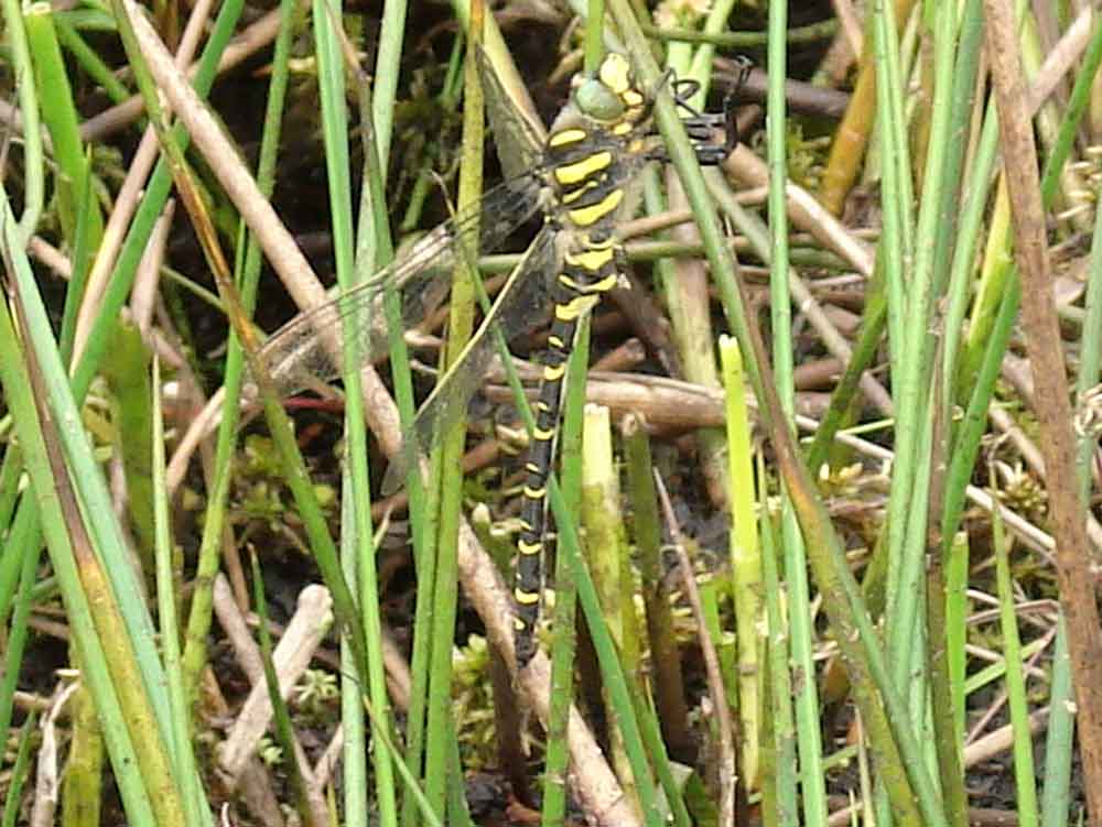
Golden-ringed dragonfly, Cordulegaster boltonii, on soft rush.
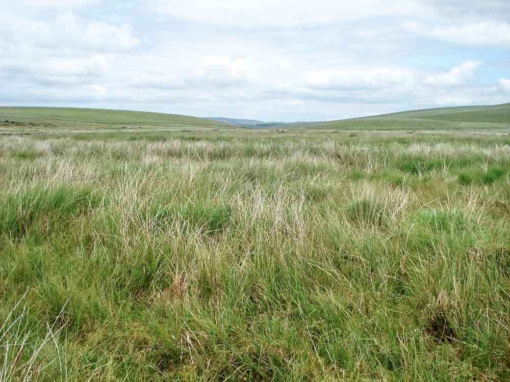
General view from the centre of Fox Tor Mire, looking east towards the Swincombe valley.
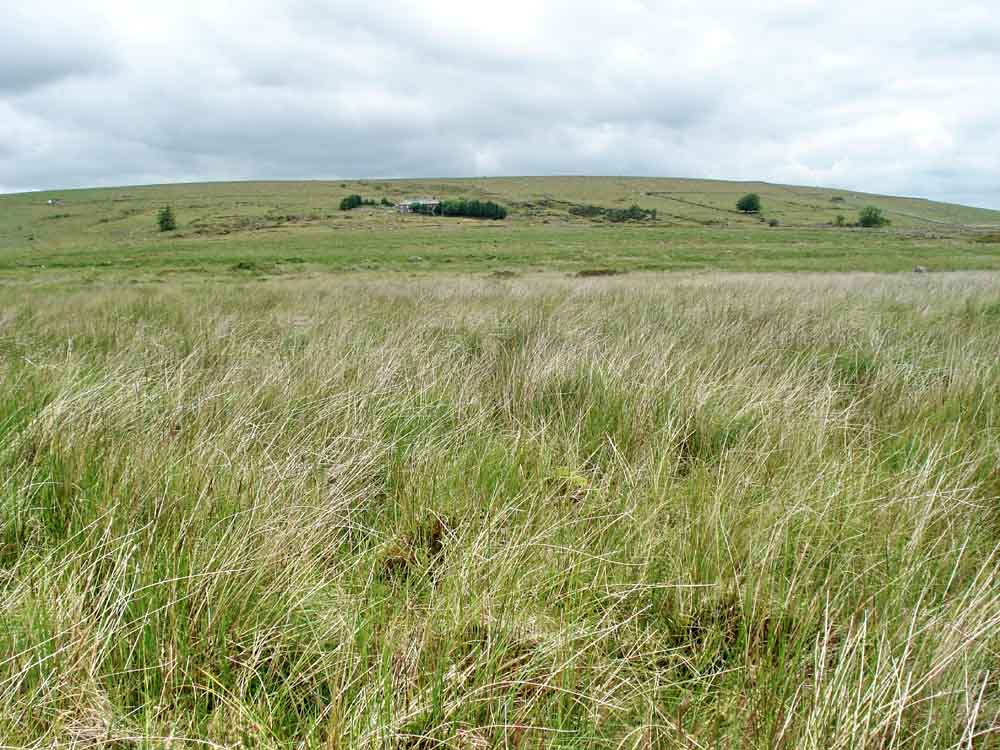
View back to terra firma, Whiteworks.
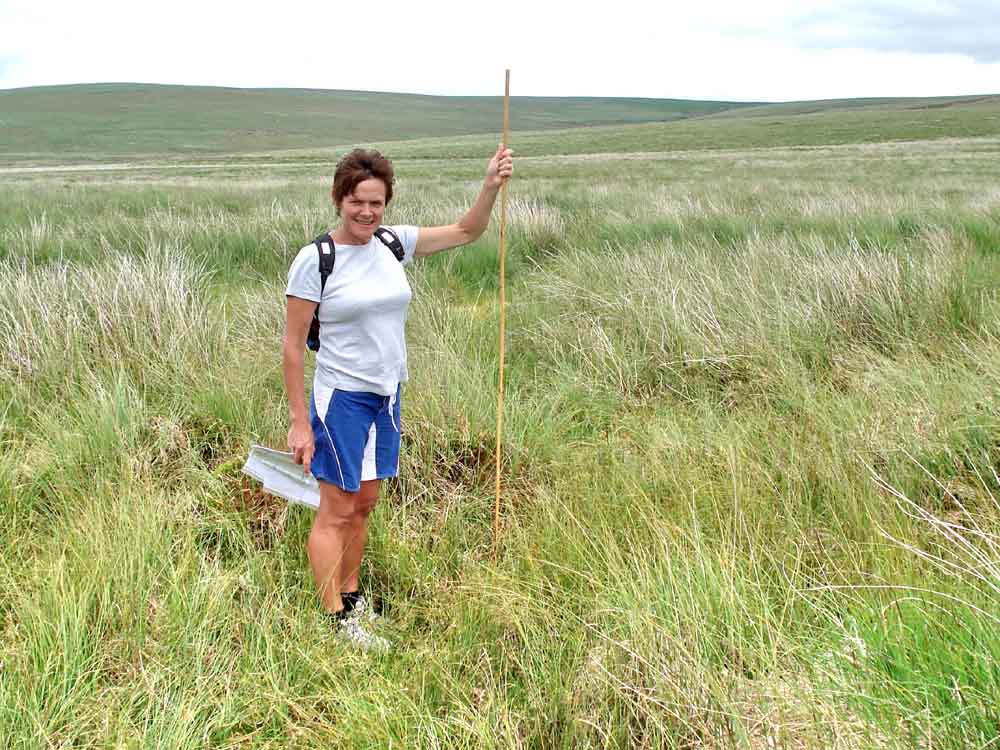
Probing the mire with a six foot (72") or 1.8 metre bamboo .....
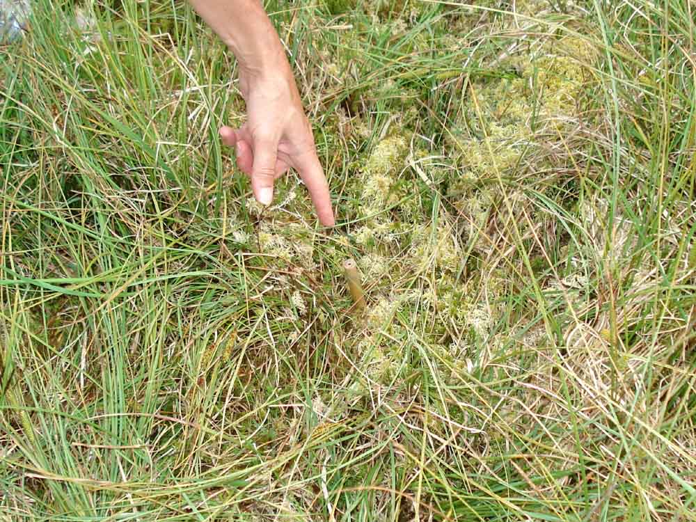
Here the bamboo is poked into the mire and only a couple of inches left protruding by which to pull it out again - PLEASE NOTE !
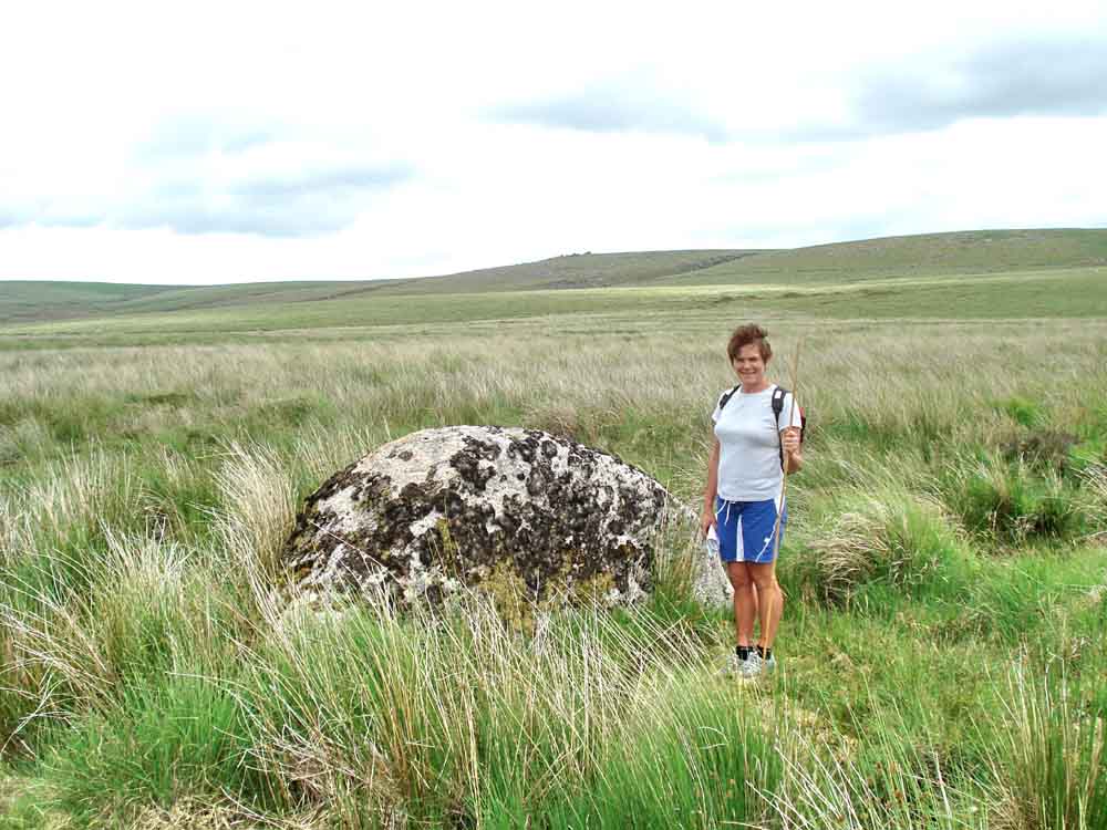
The large isolated rock near the "FB" position in the middle of the mire .....
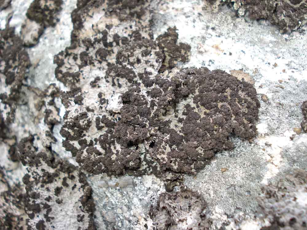
The rock bears a lot of one type of foliose (leaf-like) lichen, Rock tripe, Lasallia pustulata, and not Crottle, Parmelia saxatilis, as first thought.
The following photos were taken with a sample of the lichen under a dissecting microscope .....

A close-up of the pustular appearance of the thallus, this is the very thin layer that is the plant body ..... this was a dry area of the lichen .....

A similar photograph but of a wet area of lichen, note the brownish colour .....

An isolated area of very dark brown/black branching isidial outgrowth - these pieces break off and form a complete new lichen (comprising both the algal and fungal components of the composite symbiotic plant community that is a lichen) .....

Another isidial area .....

An area of thallus showing both the seemingly efflorescent isidial structures and the pustular "bumps" in the leaf-like lichen .....

A view of the under-surface of the thin, paper-like lichen thallus; the irregular black cavities are where the thallus has "bubbled up" to form the pustules seen from the top surface of the lichen.
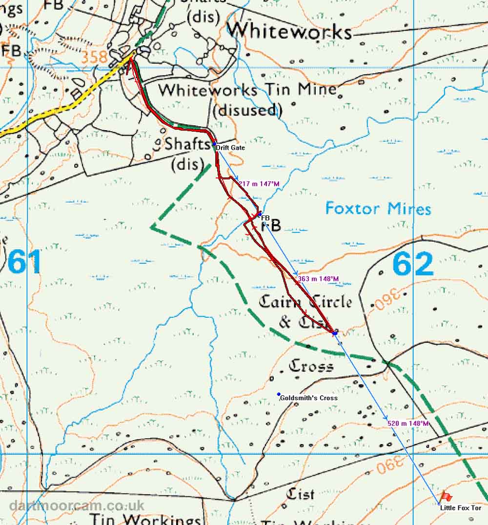
MAP: Blue = planned route, Red = GPS satellite track of the walk.
The blue lines are the compass or GPS bearings. The red line is the route actually walked: it deviates sometimes from the blue lines to avoid obstacles such as thick bracken, gorse, bogs or clitter, and often to use paths or animal tracks that are not on the map. It may also be shorter than the planned (blue) route if the walk is curtailed for some reason.
Ordnance Survey © Crown copyright 2005. All rights reserved. Licence number
100047373.
Also, Copyright © 2005, Memory-Map Europe, with permission.
See 24 June 2010 for access and parking details.
All photographs on this web site are copyright ©2007-2016 Keith Ryan.
All rights reserved - please email for permissions