|
F11 - Full screen F11 - Normal view Home & Contents |
|
"Alt" + � |
|||
This walk: 2011-11-16. Silver birch tree, witch's broom, Sticklepath Wood, River Walkham, Roborough Common, Screw Bridge, Sustrans National Cycle Route 27, moss, new Gem Bridge on site of the Brunel's River Walkham viaduct, bracket fungus, honey fungus.
Walk details below - Information about the route etc.
We had a sunny walk from the same car park on 10 June 2009.
Silver birch tree bearing several examples of Witch's broom. From the Wikipedia entry: Witch's broom growths last for many years and can be caused by many different types of organisms, such as fungi, oomycetes, insects, mistletoe, dwarf mistletoes, mites, nematodes, phytoplasmas and viruses. Human activity is sometimes behind the introduction of these organisms; for example when a person prunes a tree improperly, leaving the tree susceptible to disease.
A general view of the path through Sticklepath Wood.
Attempting to show the steepness of the valley side down to the River Walkham.
A fine figure of a tree!
Another general view.
View on the top of the down, this being the northern end of Roborough Down. The down has been exploited for 1,000s of years, including by the Romano-British, Saxons, Normans etc. It was felled, coppiced, hunted, rabbitted, cultivated etc. There are old field boundaries, raised banks (possibly from raised bed crop growing?), ridge and furrow, lynchets and lazy beds. There were at least six mines in the area, for copper, tin, lead and arsenic.
Looking at Screw Bridge from the railway track embankment - is the name corrupted from "Skew Bridge", where a bridge runs obliquely across an obstacle? In this instance, it is an unusually sloped bridge. This the South Devon & Tavistock Railway (1859) with five viaducts and three tunnels: the line closed in 1962 .....
Moor Strollers on Screw Bridge.
The path along the top of the railway embankment.
Still on Screw Bridge, where once again, many and varied things were discussed! As with the last time we were here (26 Jan. 2011), my offerings (and I'm not saying relating to what!) are Shake a hand or by The King. As before, Jim, these women are getting in on everything !!!
Looking down on the Sustrans National Cycle Route 27 (towards Tavistock) that now runs on the railway track .....
Looking towards Plymouth, this being also a section of Drake's Trail.
Fruiting bodies of a moss seen on the bridge parapet: note the fine threads that are probably gossamer from spiders.
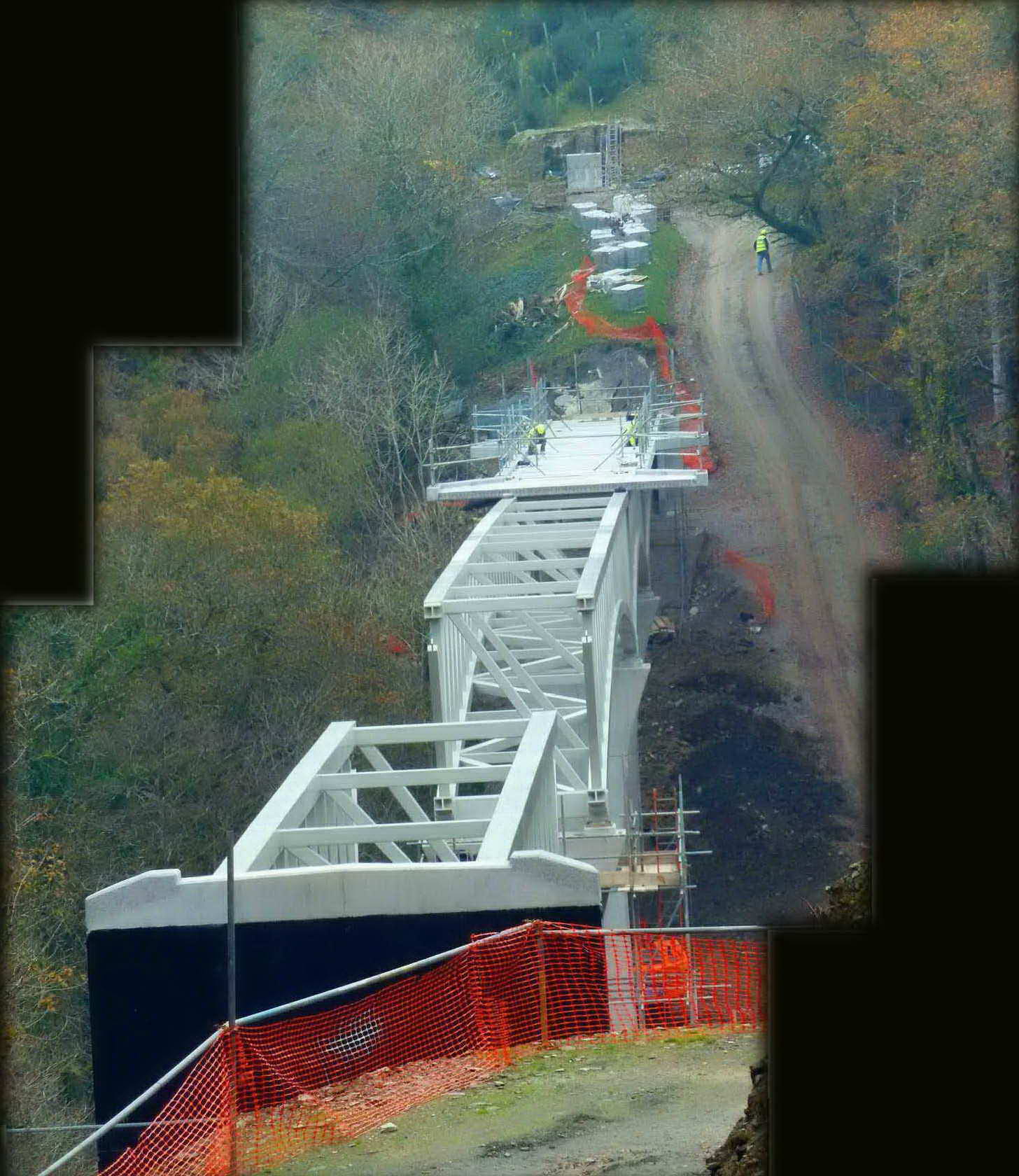
The new Gem Bridge at the site of Brunel's old Walkham railway viaduct (link with view to Gem Cottage). The scene has changed compared to 26 Jan. 2011, when there was a footbridge for walkers.
As previous photo.
As previous photo.

As previous photo.
As previous photo.
As previous photo.
As previous photo.
A probable beetle burrow and sign of deer in the woods.
Large bracket fungus on a tree.
Possibly Honey Fungus, Armillaria mellea, or Bulbous Honey Fungus, Armillaria gallica .....
As previous photo.
A section of the steep Sticklepath path: "stickle" being an old local word for "steep", the wood being called Sticklepath Wood.
Another section of the steep path.
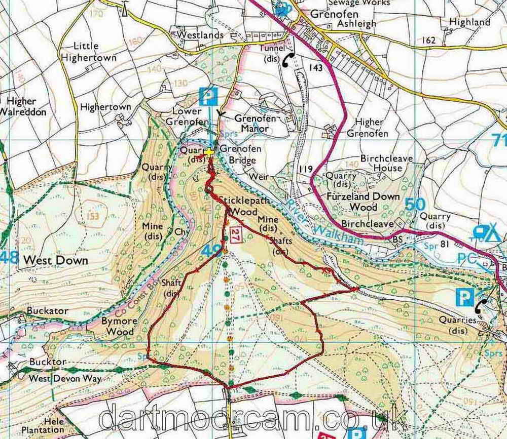
MAP: Red = GPS satellite track of the walk.

Ordnance Survey © Crown copyright 2005. All rights reserved. Licence number
100047373.
Also, Copyright © 2005, Memory-Map Europe, with permission.
Access to the walk was via the road from Yelverton to Tavistock, turning left opposite The Halfway House Inn and taking the first road left (not the private drive) and parking at the end, over the bridge, indicated by the yellow cross and P symbol on the map.
Statistics
Distance - 4.15 km / 2.6 miles
All photographs on this web site are copyright ©2007-2016 Keith Ryan.
All rights reserved - please email for permissions
Dartmoor Tick Watch
The Cornish Pasty - The Compleat Pastypaedia
